Posts in Summer 2018

Six people wearing hard hats hold straps encircling a log to carry it across a trail against a backdrop of burned trees.

An Incredible Time at Trailkeepers of Oregon

June 16, 2018 Posted by Newsletter, Summer 2018 0 thoughts on “An Incredible Time at Trailkeepers of Oregon”

By Paul Gerald, Board President, Trailkeepers of Oregon

I am humbled to be the new President of the TKO board of directors, especially at this time of growth and organization-building, which has (more…)

Restoring the Angel’s Rest Trail

June 16, 2018 Posted by Newsletter, Summer 2018 0 thoughts on “Restoring the Angel’s Rest Trail”

By Elaine Keavney, Board Member, Trailkeepers of Oregon

The Angel’s Rest Trail was heavily affected by the Eagle Creek Fire, and TKO volunteers were eager to get to work on the restoration of this popular trail. The first volunteers began work on the section just below the Coopey Creek bridge on March 3, 2018. (more…)

An Interview with Connie Soper

June 16, 2018 Posted by Newsletter, Summer 2018 0 thoughts on “An Interview with Connie Soper”

By Michael McDowell, Newsletter Editor, Trailkeepers of Oregon

In early May, John Sparks and Michael McDowell sat down for a discussion with Connie Soper, author of Exploring the Oregon Coast Trail: 40 Consecutive Day Hikes from the Columbia River to the California Border, the first day-by-day guidebook to the trail running the length of the Oregon coast. First proposed in 1959 and under construction since 1971, the Oregon Coast Trail (OCT) runs along beaches, over headlands, across sand dunes, and through coastal forests and beach towns. The trail is about 90 percent complete; a number of gaps, totaling over 40 miles, require walking alongside busy US Highway 101. To avoid highway hiking, Soper’s book arranges hikes in a series of day-long segments, from Fort Stevens in the north to Crissey Field State Recreation Site in the south.

(more…)

Digging into the Wygant Peak Trail

June 16, 2018 Posted by Newsletter, Summer 2018 0 thoughts on “Digging into the Wygant Peak Trail”

By Chip Andrus, Volunteer Trail Crew Leader, Trailkeepers of Oregon

Beginning at the Mitchell Point Overlook parking lot, about seven miles west of Hood River, the Wygant Peak Trail takes off near the Columbia River, then snakes four miles up a 2,200-foot-high peak. It’s not well known, but it’s classic Gorge—featuring a waterfall, two cascading streams, sheer cliffs, old conifers and oaks, and stunning views. And since last year’s Eagle Creek Fire didn’t spread this far east, this trail remains green—and open.

A woman wearing a hard hat and a backpack of tools walks on a large wet log across a creek bordered by rocks and logs encased in thick green moss.

Crossing Perham Creek on the Wygant Trail. (Photo by Chip Andrus)

(more…)

Hike of the Season: Mount Mitchell and Cottonwood Meadows

June 16, 2018 Posted by Hike of the Season, Newsletter, Summer 2018 0 thoughts on “Hike of the Season: Mount Mitchell and Cottonwood Meadows”

By John Sparks, Board Member, Trailkeepers of Oregon

The 2009 Omnibus Public Land Management Act added to existing wilderness areas in the Mount Hood National Forest, and also created three new wildernesses in that forest: the five-part Clackamas Wilderness, the Lower White River Wilderness (shared with the Bureau of Land Management), and the Roaring River Wilderness, encompassing slopes north and south of the Roaring River and including that pristine stream in its entirety. The southern boundary of this wilderness includes a rugged basalt rim that is little visited but offers wide-ranging views into the Clackamas drainage as well as up and down the Cascades. The Rimrock Trail, which appears in only a couple of hiking guidebooks, takes you to two compelling destinations here, one on the rim itself and the other in a glacial cirque below. Wildflower lovers will also like this hike in mid-summer, when you’ll find forest and meadow plants at the height of the bloom.

An exposed rock cliff topped by coniferous trees with mountains in the distance under a blue sky.

View west along the rimrock from the Mount Mitchell Viewpoint. (Photo by John Sparks)

(more…)

The Beauty of the Penstemon

June 16, 2018 Posted by Newsletter, Summer 2018 0 thoughts on “The Beauty of the Penstemon”

By John Sparks, Board Member, Trailkeepers of Oregon

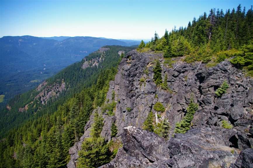
At the Mount Mitchell Viewpoint, you’ll see an abundance of what is arguably the showiest penstemon in our area, the bright pink rock penstemon (Penstemon rupicola). In Oregon, this plant seems to sprout straight out of sheer basalt cliffs throughout the Cascade Range from almost sea level to 4,500 feet (look for it also on the cliffs of Mitchell Point in the Columbia Gorge). Like all other penstemons, the corollas of the rock penstemon are attractively tubular and attract hummingbirds. The Native Plant Society of Oregon lists 46 penstemon species as native to the state. They range in color from white to red and grow in alpine, riverine, and desert habitats, and all are sun-loving. Most of Oregon’s species are some shade of purple or blue, which may make them difficult to identify except through an identification key. This generally involves paying attention to the stamens, calyces, corolla color, and leaf margins.

Pinkish-purplish flowers against a backdrop of leaves and rock.

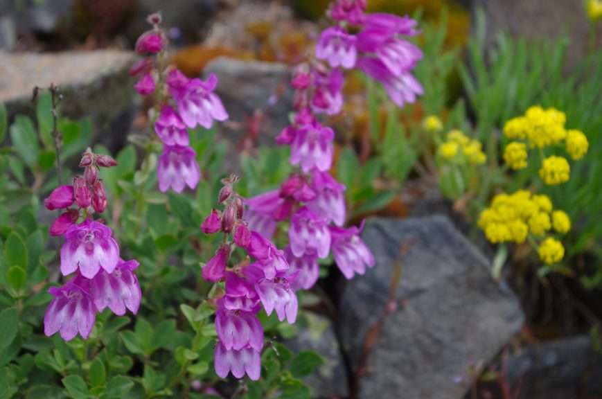
Shrubby penstemon (Penstemon fruticosus), Monte Carlo, Gifford Pinchot National Forest. (Photo by John Sparks)

(more…)

Bull of the Woods Lookout Hike Includes Views and History

June 16, 2018 Posted by Newsletter, Summer 2018, Uncategorized 0 thoughts on “Bull of the Woods Lookout Hike Includes Views and History”

By Cheryl Hill, Board Member, Trailkeepers of Oregon

The extremely dry summer of 1910 made for a bad fire year. Three million acres burned in the Big Blowup in Idaho and Montana. Numerous fires burned in Oregon, including one that burned 60,000 acres in what is now the Rogue River-Siskiyou National Forest. After those fires the US Forest Service began installing a network of fire lookouts and guard stations so that fires could be spotted early and put out immediately. This network expanded greatly during the 1930s with the help of the Civilian Conservation Corps. They built many lookouts as well as the trails that led to them.

A cabin on stilts in the foreground with a snowy peak in the background.

The Bull of the Woods lookout and Mount Jefferson. (Photo courtesy of US Forest Service)

(more…)

Subscribe for News and Events