By Cheryl Hill, Board Member, Trailkeepers of Oregon If you find yourself visiting the Painted Hills unit of the John Day Fossil Beds National Monument and you want a longer hike than those short trails provide, Sutton…
By John Sparks, Board Member, Trailkeepers of Oregon
The 2009 Omnibus Public Land Management Act added to existing wilderness areas in the Mount Hood National Forest, and also created three new wildernesses in that forest: the five-part Clackamas Wilderness, the Lower White River Wilderness (shared with the Bureau of Land Management), and the Roaring River Wilderness, encompassing slopes north and south of the Roaring River and including that pristine stream in its entirety. The southern boundary of this wilderness includes a rugged basalt rim that is little visited but offers wide-ranging views into the Clackamas drainage as well as up and down the Cascades. The Rimrock Trail, which appears in only a couple of hiking guidebooks, takes you to two compelling destinations here, one on the rim itself and the other in a glacial cirque below. Wildflower lovers will also like this hike in mid-summer, when you’ll find forest and meadow plants at the height of the bloom.
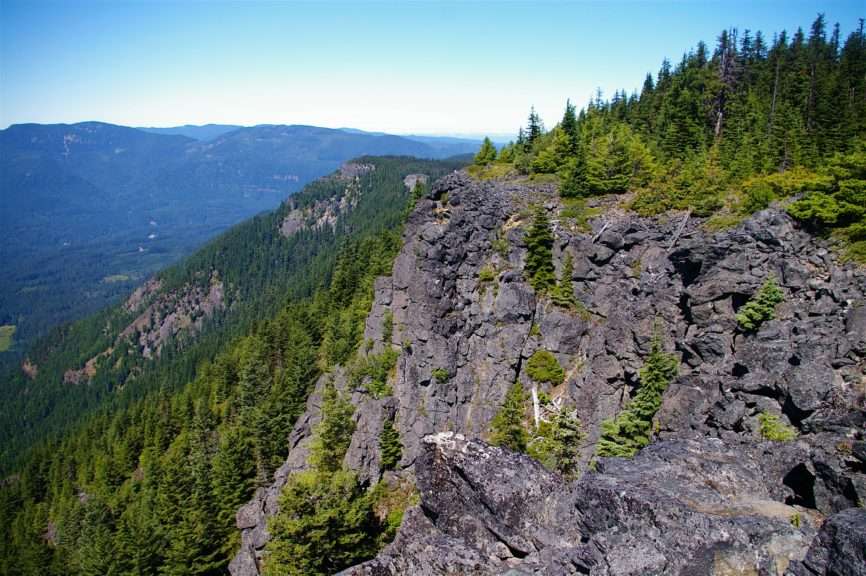
View west along the rimrock from the Mount Mitchell Viewpoint. (Photo by John Sparks)
You’ll begin on the Rimrock Trail #704, but note that existing US Forest Service information, US Geological Survey topo maps, and even Caltopo still show the location of the old trailhead off a spur of Forest Road 140. Make sure that you instead follow the directions to the current trailhead given in the Oregon Hikers Field Guide! Except in late summer, the hike begins with a rather boggy crossing of the headwaters of the South Fork Cripple Creek. A spur leads right to a view down the Cascade crest toward Mount Jefferson. Then, whether you notice it or not, you’ll pass the junction with the for-abandoned-trail-aficionados only Milepost 3 Trail (there’s a sign saying “704” tacked to a tree here), a steep and rugged 1,800-foot descent to Forest Road 4635. Another hardly noticeable spur leads off to the right to an old Forest Service helipad at Good Spring. After almost two miles, you arrive at the junction with the Mount Mitchell Trail.
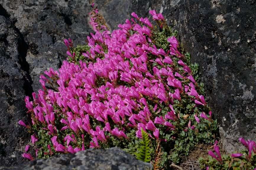
Rock penstemon (Penstemon rupicola) blooming at the Mount Mitchell Viewpoint. (Photo by John Sparks)
Go right here, and walk up through shady woods about half a mile. You may notice strands of rusting #9 galvanized wire next to the trail. This served as the telephone link to a Forest Service lookout position at the Mount Mitchell Viewpoint on a high basalt rim overlooking the Oak Grove Fork of the Clackamas River (there was apparently no lookout structure here; personnel would carry in a portable phone and clip it to the wire). Roam around the rimrock to get clear views down to Cottonwood Meadows and north to High Rock, Mount Hood, Mount Adams, and Mount Rainier. Your views south down the Cascades are limited only by the horizon, extending past Mount Jefferson and Three Fingered Jack to the Three Sisters and Mount Bachelor. The location was, in fact, originally named Oak Grove Mountain but was renamed to honor Roy Mitchell, who perished while firefighting in 1919. Note also that the actual summit of Mount Mitchell is on the eastern rim of this upland about 0.6 miles north of the viewpoint.

View to Mount Jefferson from the Mount Mitchell Viewpoint. (Photo by John Sparks)
It’s difficult to tear yourself away from this spot, for in addition to the splendid views, a visit in July brings you here at the top of the wildflower bloom. Bright pink rock penstemon blossoms in crevices among the clumps of pinemat manzanita. Large Washington lilies are obvious, as are red mountain heather and bright yellow arrow-leaf groundsel. Bleeding heart should still be in flower in shady areas and two other penstemons, light purple Cardwell’s and woodland, add patches of color.
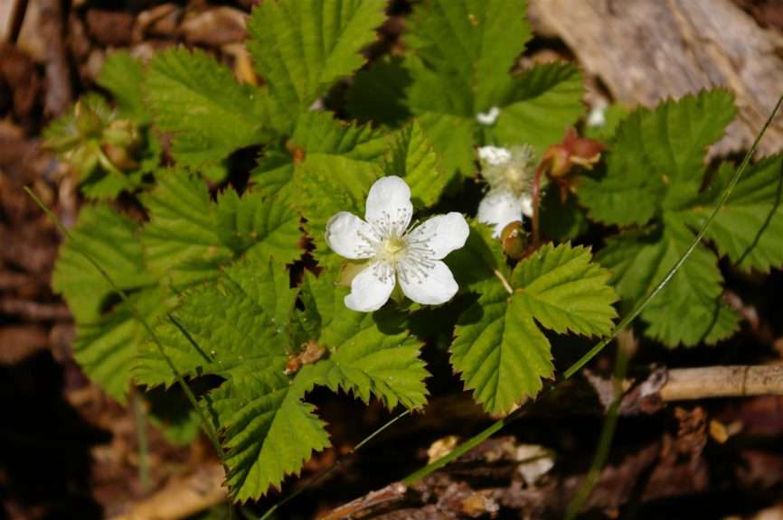
Dwarf bramble (Rubus lasiococcus) on the Rimrock Trail. (Photo by John Sparks)
If the five-mile out-and-back hike to the Mount Mitchell Viewpoint isn’t enough, you can almost double your distance by returning to the trail junction and continuing east along the Rimrock Trail to Cottonwood Meadows. You’ll reach a talus rim, home to alarm-calling pikas, near the true summit of Mount Mitchell. Then you need to descend through a montane forest of mountain hemlock, silver fir, and noble fir, switchbacking several times, before you exit the wilderness at Forest Road 5830. Cross the road, and gently descend to pass several seasonal tarns. Reach the lush meadows bordering shallow Cottonwood Lake, which fills an old glacial cirque. From here, a track follows the west shore of the lake along the edge of the forest. This is another great wildflower walk, so keep your eyes open for white bog orchids, false hellebores, marsh marigolds, mertensia, paintbrush, and arrow-leaf groundsel. Mosquitoes are still active here throughout the summer, though, so make sure you are well prepared for concentrated aerial attacks!
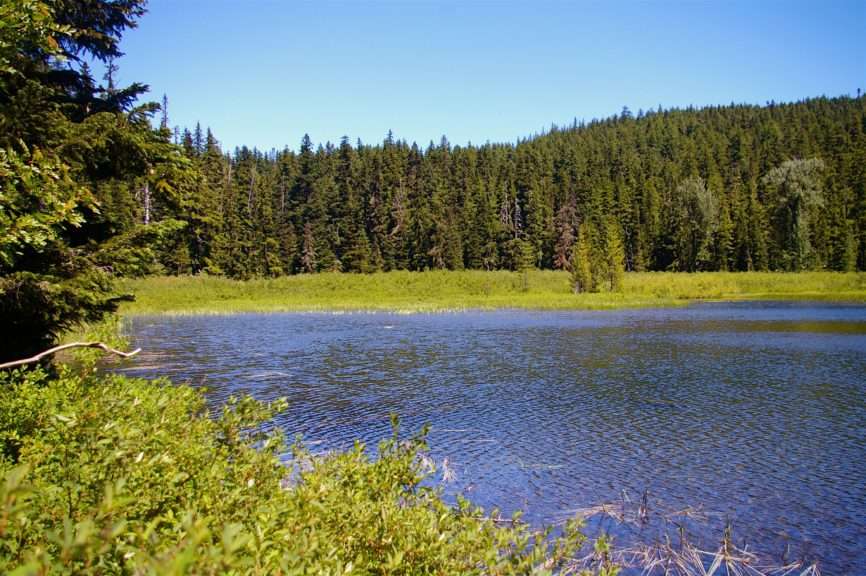
The lake at Cottonwood Meadows. (Photo by John Sparks)
A trace of an abandoned section of trail skirts a clearcut and descends gradually, then precipitously to Forest Road 4635-120. You’ll need to have excellent off-trail skills to attempt this, however, and then you’ll need to get back to the trailhead! Be satisfied with your day, and return the way you came.
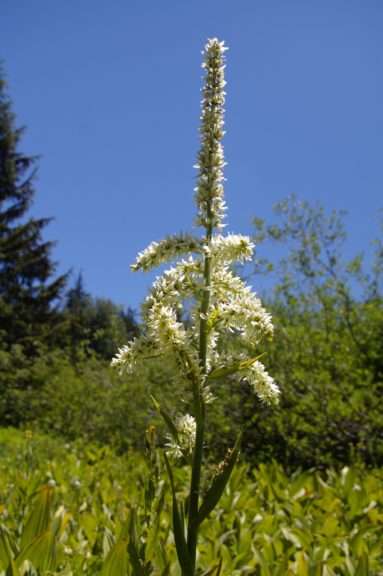
White false hellebore (Veratrum album) at Cottonwood Meadows. (Photo by John Sparks)
See the hike in the Oregon Hikers Field Guide: Mount Mitchell-Cottonwood Meadows Hike.
John Sparks: john.sparks@trailkeepersoforegon.org
