By John Sparks, Board Member, Trailkeepers of Oregon The 2009 Omnibus Public Land Management Act added to existing wilderness areas in the Mount Hood National Forest, and also created three new wildernesses in that forest: the five-part Clackamas…
By John Sparks, Board Member, Trailkeepers of Oregon
Distance: 10.1 miles / Elevation gain: 75 feet
In 8,000-acre Cottonwood Canyon State Park, Oregon’s second-largest state park, a jeep track travels along the side of the John Day River to access a cattle corral nestled under a cliff of columnar basalt.
The journey to the corral involves alternating sagebrush flats with rocky traverses below high cliffs that host nesting raptors and cliff swallows. Part of this hike takes you along a tranquil side channel of the river. A short loop from the corral finishes the hike unless you want to take to the high ridges for an off-trail excursion.
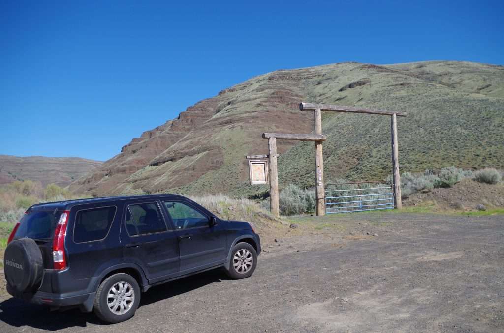
The hike to the Lost Corral begins at the J. S. Burres State Wayside. (Photo by John Sparks)
Pass through the trailhead archway and follow a gravel track across a sagebrush flat. You’ll get good views of the Cottonwood Canyon State Park’s buildings, including the Murtha Ranch Barn, on the opposite side of the river. Walk by a lone juniper and reach the river verge at a gate and hackberry tree under a high basalt wall. Reach a broad flat at a bend in the John Day River and get good views of the cliffs across. Leaving the flat, the track rises on a rocky tread under cliffs of columnar basalt. In spring, cliff swallows are building their mud nests here, and there is constant activity.
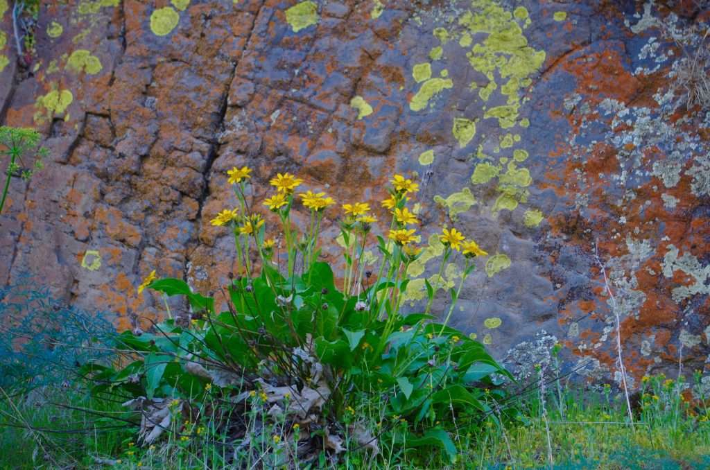
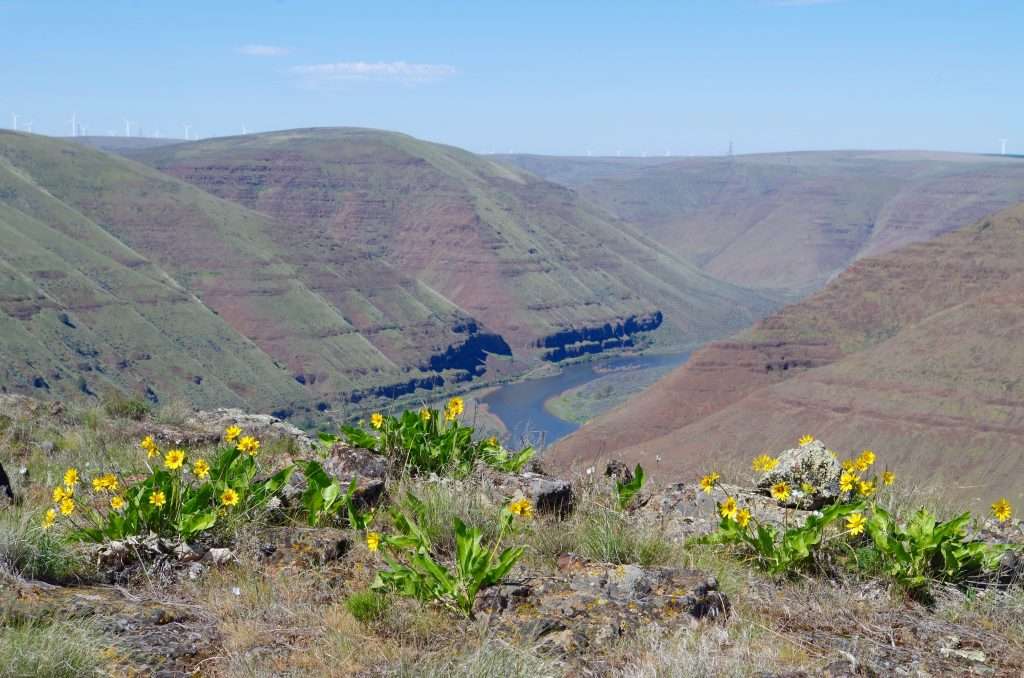
Balsamroot in bloom against a lichen-covered basalt cliff. (Photo by John Sparks)
Now you’re hiking along a lush, quiet channel of the river lined by golden current, mock orange, and wild rose. Look above you at slopes of balsamroot. Pass a couple of ranch arches at a draw and then hike a sandy track across a grassy flat to the base of high basalt cliffs. American kestrels nest in these cliffs; also, look carefully to see the “Let Me Insure Your House” advertisement painted across cliff rocks. Walk below the rugged mouth of Rattlesnake Canyon, with its intermittent waterfall, and reach the Lost Corral.
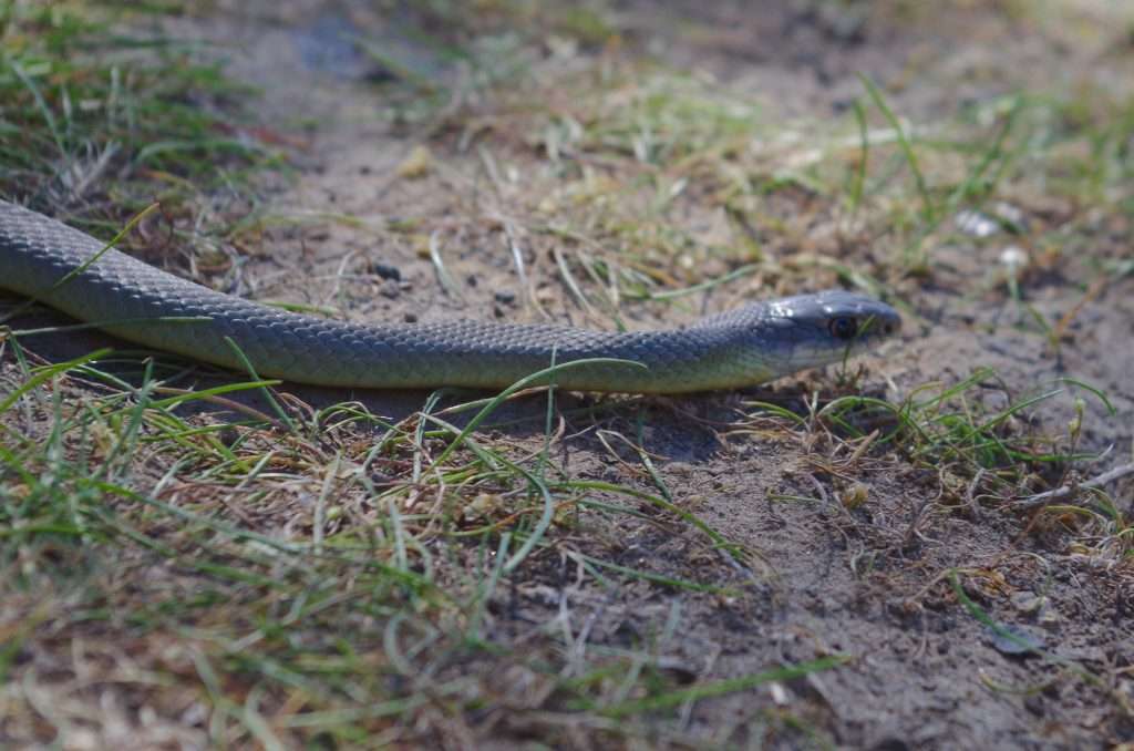
A yellow-bellied racer (Coluber constrictor) crossing the trail. (Photo by John Sparks)
Take a while to explore the corral area, with its cattle chute and pens and shady hackberry: These useful trees, members of the cannabis family, are near the northern end of their range here. Passing through the corral, follow the road track to where it splits: Going right leads up broad Esau Canyon. Instead, keep left at the signage for the Esau Loop Trail. The trail leads up a grassy sagebrush bench to offer views of the river, the tip of the Gooseneck Peninsula, and the red cliffs at the next bend. Descend to the river, keeping an eye out for rattlesnakes. Reaching the river, bear left on a wide grassy track to reach an archway. Keep right along the fence line to reach the farm road that will take you back to the trailhead.
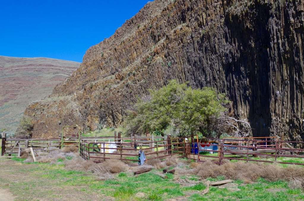
The “lost corral’’ and its lone hackberry tree nestled against cliffs of columnar basalt. (Photo by John Sparks)
More details about the hike and trailhead information—as well as a description of an off-trail option above Esau Canyon—can be found in the “Lost Corral Hike” entry in the Oregon Hikers Field Guide.
A view down to the John Day River from the ridge above Esau Canyon. (Photo by John Sparks)
John Sparks: john.sparks@trailkeepersoforegon.org