By Cheryl Hill, Board Member, Trailkeepers of Oregon After a week of sitting inside at my desk job I need time out on the trail. I hike for fresh air, hearing birds sing, smelling the forest, viewing sweeping…
By Maegan Jossy, Board Member, Trailkeepers of Oregon
Hikers have once again been enjoying the classic five-mile Multnomah-Wahkeena waterfall loop trail in the Columbia River Gorge Scenic Area, which reopened at the end of May. The trail had been closed since April 5, when large rocks fell onto it. Luckily no one was hurt then, and the US Forest Service gave hikers hardhats and escorted them off the trail. The rockslide illustrates the instability of the terrain burned in the 2017 Eagle Creek fire and the need for continual maintenance of trails in the burned area.
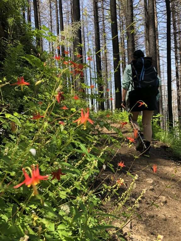
Columbine blossom this June along the reopened Multnomah-Wahkeena loop trail. (Photo by Maegan Jossy)
Trailkeepers of Oregon has been coordinating with the US Forest Service to bring the trails affected by rockfalls around Multnomah Falls back to hikable condition. A TKO trail party prepared the trail sections above Benson Bridge for the Forest Service to blast an unstable rock ledge over the trail that was likely to drop more rocks. TKO volunteers also cleared rock from the switchbacks above Wiesendanger Falls in preparation for the Forest Service to install gabions (rock-filled wire baskets used in retaining walls).
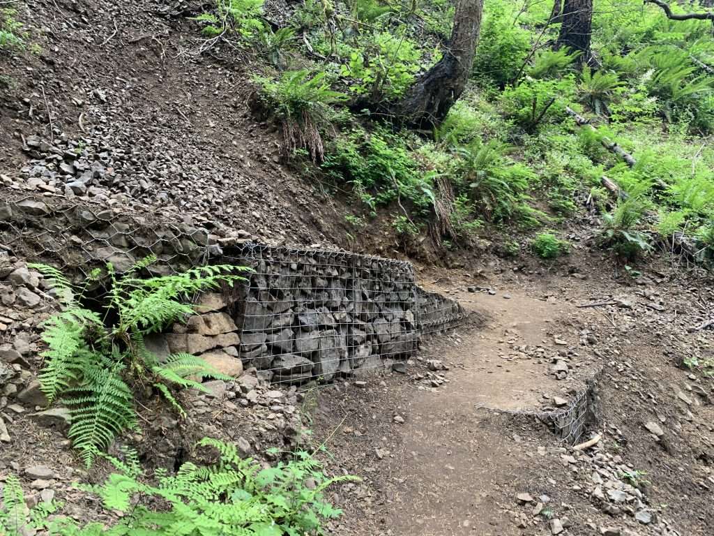
Gabions supporting an unstable portion of Larch Mountain Trail #441 above Wiesendanger Falls on the Multnomah-Wahkeena Loop. (Photo by Michael McDowell)
TKO and partner agencies—the US Forest Service, Oregon State Parks, Pacific Crest Trail Association, and others—have worked to make trails safe to hike after the fire. Hikers have been eager to see the scars of the burn and to observe how the forest is regenerating. But the innate risks of hiking increase on a trail through the area burned by the Eagle Creek fire. The trees, brush, ferns, and mosses that hold the rock and soil of a hillside in place have often been burned away. It’s advisable not to hike the area in strong winds or exceptionally rainy weather, which increase the possibility of falling trees and limbs, rockfalls, landslides, and debris flows. It’s always a good idea to keep an eye out for hazardous trees, snags, rocks and unstable ground above burned-out root systems. If you’re hiking with small children or dogs, it might be better to choose safer trails—-TKO’s Oregon Hikers Field Guide lists over a thousand hikes to choose from! If you do encounter bad or unsafe trail conditions, TKO encourages you to flag the problem with a post on the Oregon Hikers’ Trail Rx forum, briefly describing the problem, identifying the location, and, if possible, providing a photo. Posting on the forum requires the slight inconvenience of registration and logging in, but the information is valuable for TKO and the Forest Service to know what needs attention.
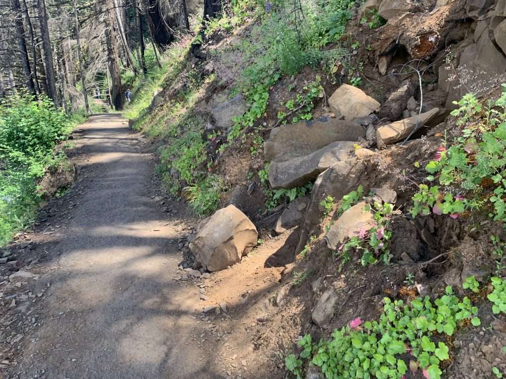
The Eagle Creek fire has loosened rocks on the Gorge’s slopes, as on this portion of Larch Mountain Trail #441 above Benson Bridge. (Photo by Michael McDowell)
As surely as rain will fall and winds will blow, there will continue to be a need for volunteers to work on trails in the Gorge. Consider signing up for a volunteer trail work party or donating to help pay the expenses of keeping the trails in a condition to hike!
Maegan Jossy: maegan.jossy@trailkeepersoforegon.org